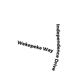
18 INDEPENDENCE DR
Owner Information
SAPPOR SAMUEL TEI ETUX
18 INDEPENDENCE DR
LEOMINSTER, MA 01453


Property Details
18 INDEPENDENCE DR is classified as a Single Family Residential (Colonial).
The primary structure on this property was built in 1994. There are 4,362ft2 of built area within this property. There is 1,946ft2 of residential/living space within this property. This property is listed as having 7 rooms.
18 INDEPENDENCE DR is valued at $396,500. The land is valued at $114,200 and the structures are valued at $277,300. There is an additional valuation of $5,000 on this property.
This property is in Zone RA. Confirm with local Zoning Board authorities to ensure there are no overlays or other easements on this property.
The most recent deed for 18 INDEPENDENCE DR is recorded at the local registrar in Book 9007, Page 238. 18 INDEPENDENCE DR was last sold on Thursday, January 25, 2018 for $350,000.
Assessment data from fiscal year 2021.
Flood Data
According to the FEMA National Flood Hazard Layer, this property does not appear to be in a flood zone. It may also be in an area not yet reviewed. Nonetheless, confirm this information prior to taking any action.
To view the flood hazards around this property, create a FEMA "Firmette" Map of the area around 18 INDEPENDENCE DR.
Broadband Internet Providers
| Provider | Type | Bandwidth (mbps) | |
|---|---|---|---|
| Verizon New England Inc. | Fiber | 940 | 880 |
| GCI Communication Corp. | Satellite | 0 | 0 |
| HughesNet | Satellite | 25 | 3 |
| Comcast | Cable | 1000 | 35 |
| VSAT Systems, LLC. | Satellite | 2 | 1 |
| Viasat Inc | Satellite | 100 | 3 |
| Verizon New England Inc. | DSL | 5 | 0 |
Broadband service provider data from December 2020.
Adjacent Properties
- 29 BICENTENNIAL AV
Single Family Residential owned by DELLAMONACA CHRISTINE F - 35 BICENTENNIAL AV
Single Family Residential owned by SOWERBUTTS DONALD J ETUX - 24 INDEPENDENCE DR
Single Family Residential owned by MORAN ANDREW V ET UX - 84R INDEPENDENCE DR
Undevelopable Residential Land owned by DELANEY DEBRA TR - 12 INDEPENDENCE DR
Single Family Residential owned by CORDIO STEVEN N ETUX